Anas Hattab’s Telegram Channel Helps West Bank Drivers Navigate Checkpoints
Nearly 350,000 people follow Hattab’s traffic updates, which fill gaps in navigation apps and supply data to local routing tools.

For drivers in the West Bank, a route can change before the journey is over. Anas Hattab built a Telegram channel around that uncertainty: Nearly 350,000 people now follow “Road Conditions” for reports on delays, closures and safer alternatives. Its updates also feed local radio coverage, business routing tools and a Palestinian traffic app.
That work began as a practical response to Hattab’s own nightly drives. In 2019, he worked as a digital designer at a Ramallah newspaper, then delivered its papers after his shift. His route took him through Nablus and Jenin before he reached his home in Tulkarm, often around dawn. Checkpoints, raids and roads he needed to avoid made each trip unpredictable.
A journey from Tulkarm to Ramallah that once took about an hour can now take two or three hours, and sometimes longer, because of checkpoints along the way. Checkpoint delays and route restrictions complicate travel across the territory. The experience of driving there can involve long waits and sudden changes, leaving people unsure whether a road will remain passable.
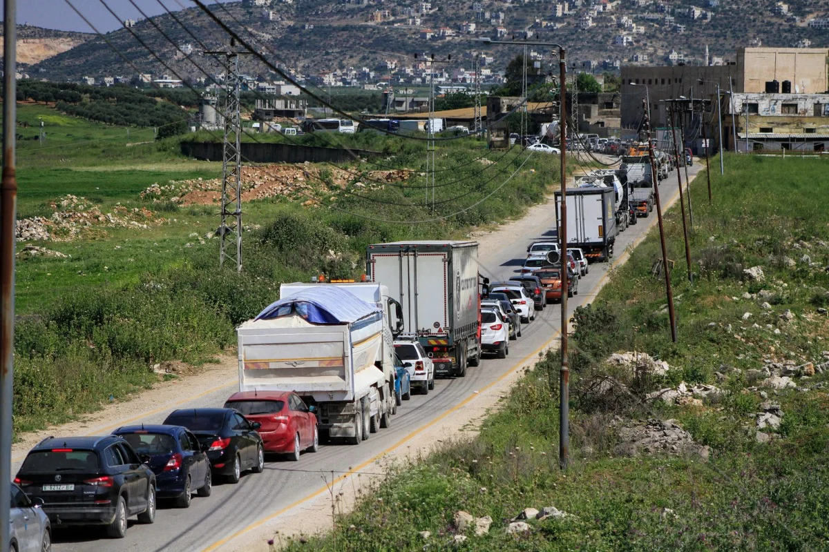
Checkpoints can stall traffic for hours, even on short journeys across the West Bank.
Photograph: Nasser Ishtayeh/Getty ImagesFilling a gap in road information
Major navigation apps don’t reflect many of the conditions Palestinian drivers face. They omit 942 checkpoints, gates and other barriers that fragment the territory, and their suggested fastest routes can pass through settlements or areas where Palestinian vehicles face restrictions. Following an app’s directions can therefore send drivers onto roads they cannot use safely.
Hattab had watched this information gap shape people’s choices. “People were scared to leave their governorates,” he says. He started Road Conditions as a Telegram group where drivers could report what they saw: delays, closures, armed presence and violence. He shared the link in local news groups. At first, members arrived slowly. As delays worsened and checkpoints multiplied from 2022, the group grew quickly.
The channel’s value depends on updates staying useful as conditions change. “Ten minutes is a long time,” Hattab says. “Things change instantly.” A checkpoint could be described as open, closed and clear within the same hour. When large cities were locked down, thousands of people could join in a short time, and dozens might ask about the same location. Hattab says he received thousands of messages a day. “In the beginning,” he says, “I barely slept.”
He closed the public chat soon after launch and asked frequent contributors to moderate the feed. More than a dozen volunteers now help assess reports sent in by drivers across the West Bank, often with a photo or video. Moderators check information by asking people nearby, comparing it with local pages or driving the route themselves. The group’s usefulness rests on that verification work, though fast-changing conditions mean no update can guarantee what a driver will encounter later.
To answer questions about unfamiliar roads, Hattab spent six months using his days off to explore without a set destination. He asked local residents for the names of checkpoints and bypass roads, gradually learning alternative routes across the territory. His car’s odometer rose from 70,000 kilometers when he started the group to 274,000 four years later. The distance is striking given that the West Bank is barely 130 kilometers from end to end.
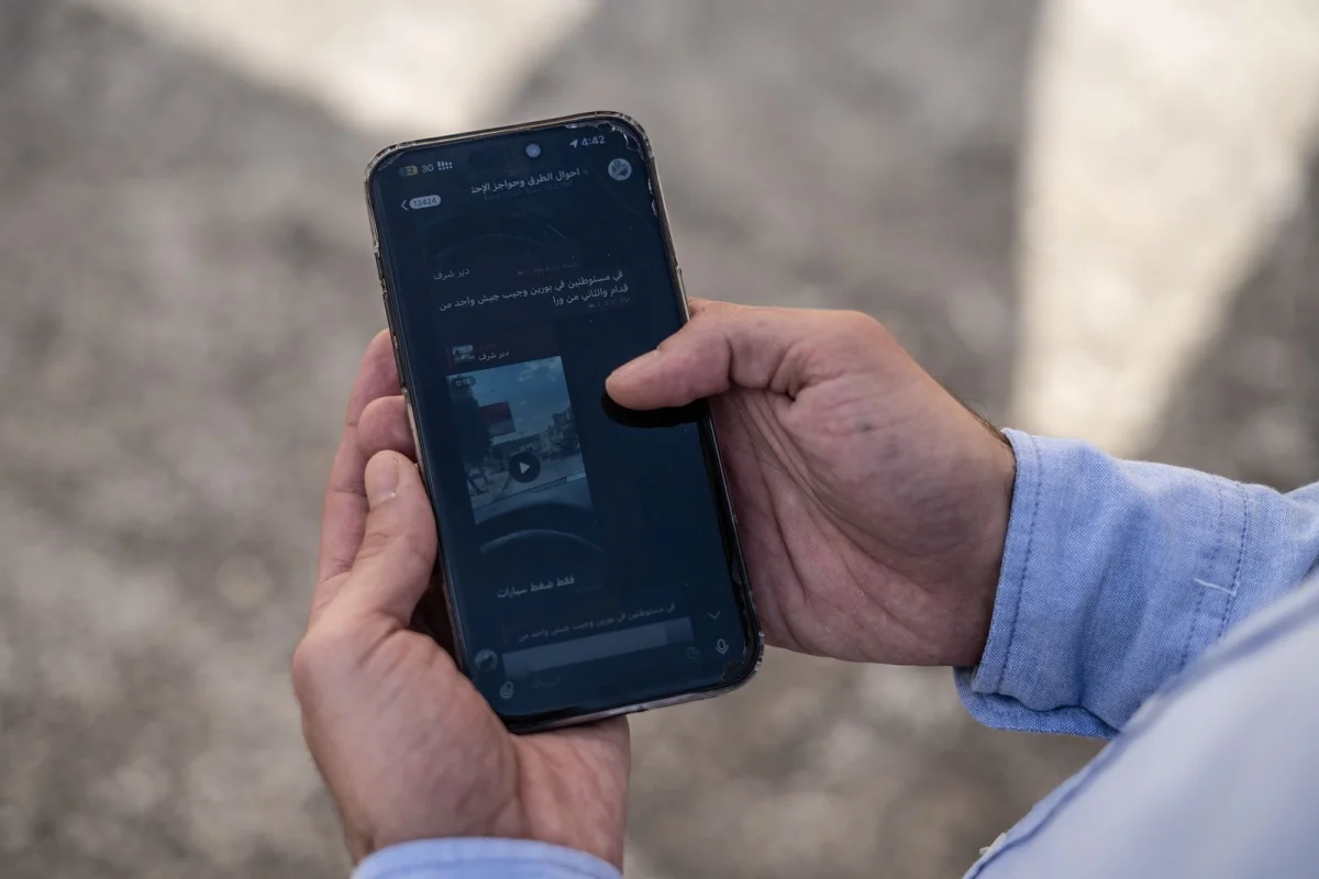
The “Road Conditions” Telegram channel provides driver reports and route updates.
Photograph: Samar HazbounFrom volunteer reports to a wider data source
Road Conditions has also become a source for understanding how checkpoint delays work. A reporting team looking for information on when checkpoints open and close found no central dataset. It instead collected channel updates to build a record of checkpoint activity. The resulting analysis found that delays had risen by more than 50 percent since October 7, 2023. It estimated that the average commuter loses about 77 hours a year taking detours to avoid checkpoints. Some journeys between towns that once took 10 minutes can now take an hour.
Hattab’s work carries personal risks. Not long after October 2023, a soldier at a checkpoint near Qalqilya stopped him while he was driving home at 2 a.m. and took his phone. The device held around 20,000 photos submitted to the channel. The soldier accused him of photographing a military site and ordered him to delete the images. Hattab erased thousands before he was allowed to leave. Since then, he says, “I make sure not to show the military jeeps, not to show one soldier.”
He later left the newspaper and became a sales representative for a construction equipment company, a job that takes him onto different roads each day. “My point is not sales,” he said. “It’s Road Conditions.” The work gives him firsthand exposure to changing routes, while his channel turns individual observations into shared information.
Threats on the road include attacks by settlers. In March 2025, at the Yitzhar junction on Route 60 near Nablus, Hattab says he saw a settler stop a coffee delivery truck and beat its driver. He posted an update to the channel. The Colonization and Wall Resistance Commission recorded nearly 5,443 settler attacks that year and about 4,766 in the first eight months of 2026.
The channel’s reports can also resolve immediate uncertainty. At 4 a.m. one January morning in 2025, people were asking whether troops remained on the road out of Tulkarm. By 7, no one knew, and drivers were reluctant to check. Hattab drove the route himself, found it clear and posted the update. “By the grace of God, it was easy this time,” he says.
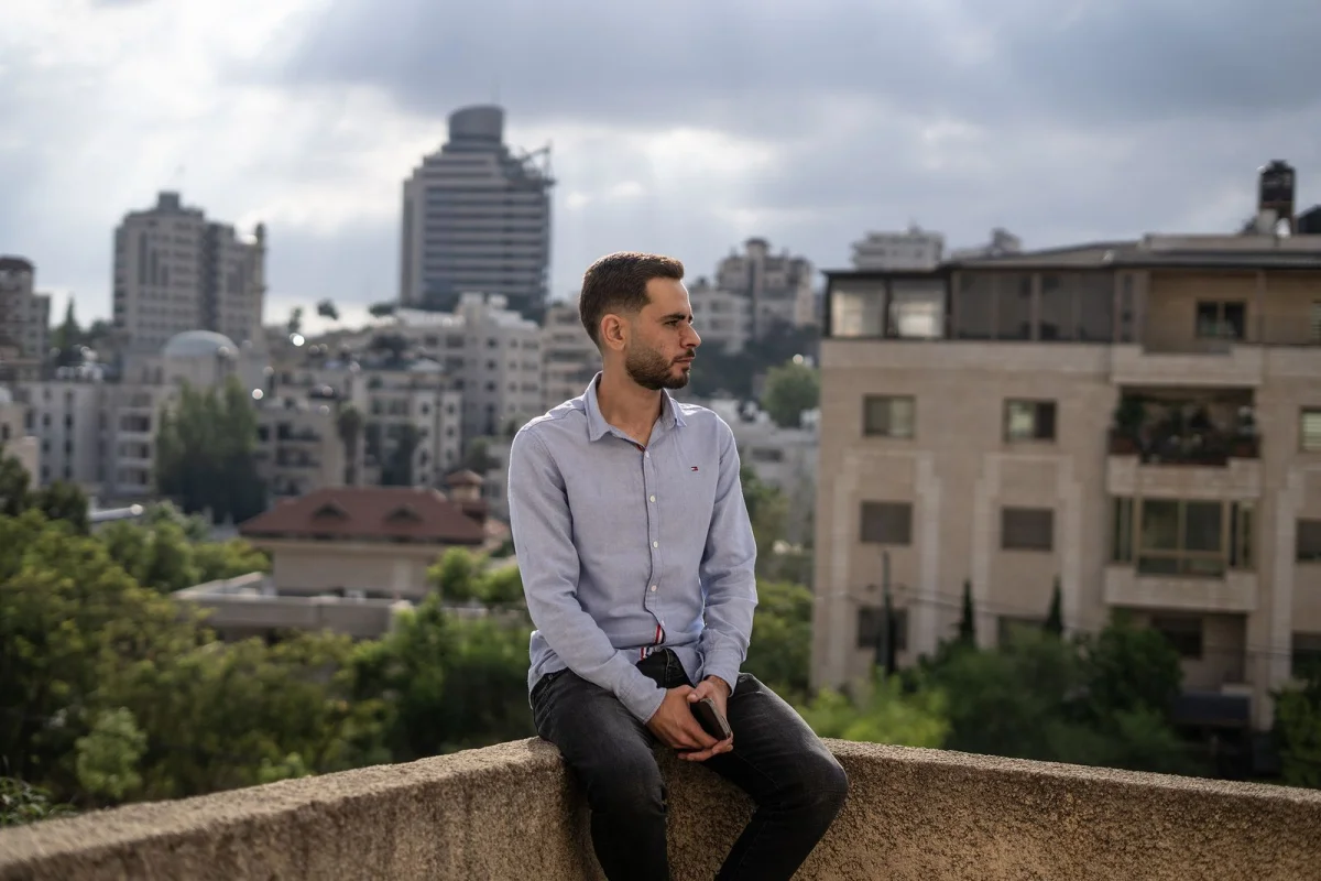
Anas Hattab created the “Road Conditions” Telegram channel.
Photograph: Samar HazbounA service built on unpaid work
Hattab says he can often anticipate how one major junction closure will affect nearby roads, with later closures following “like dominoes.” That kind of local knowledge is hard to reproduce in a conventional map: It depends on reports from drivers, familiarity with alternative routes and the ability to check details as conditions shift.
Other local efforts have tried to build navigation tools for the same conditions. In 2025, computer engineers Musab Nuirat and Ahmed Gharib launched A Ween Rayeh, or “Where Are You Heading?”, an app that combines data into a real-time traffic heat map. Nuirat counted it as the seventh local attempt to create a functional navigation system for the West Bank. Like nearly all those efforts, it relies on Hattab’s updates.
The channel’s reach has grown without institutional support, but its operating model remains fragile. Hattab has two young children and sometimes questions whether he can keep giving so much time to a volunteer service. “You’re supposed to give your family the best life, not give up stable income for a Telegram group,” he says. He believes the operation should be much larger and its moderators should be paid, but he cannot afford to compensate them. “I can’t give them more than a thank you.”
For Hattab, the responsibility comes from knowing that drivers act on the information they receive. He compares it to a taxi driver carrying passengers: “Same principle.” No one can verify every report in real time, and conditions can change between an update and a driver’s arrival. Road Conditions offers a way to make those decisions with better local information. Its continued value will depend on sustaining the volunteer network that gathers and checks that information.